
PIPELINE
Total Right-of-Way Integrity
Monitor thousands of miles of right-of-way frequently and quickly. Our AI detects encroachments, land movement, methane emissions, and liquid leaks to achieve new levels of total vigilance, protecting your assets and the surrounding environment.”
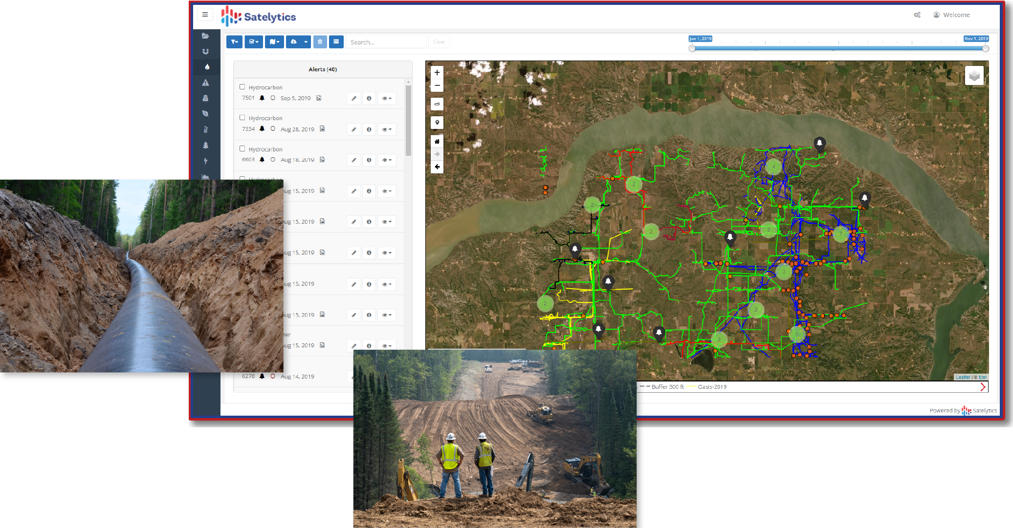
Right-of-way Vigilance
Third-party encroachments are a leading cause of failure. We monitor your entire network to identify unauthorized construction, vehicles, or structures in your ROW. Our system alerts you quickly, allowing your field teams to intervene before your infrastructure is compromised.
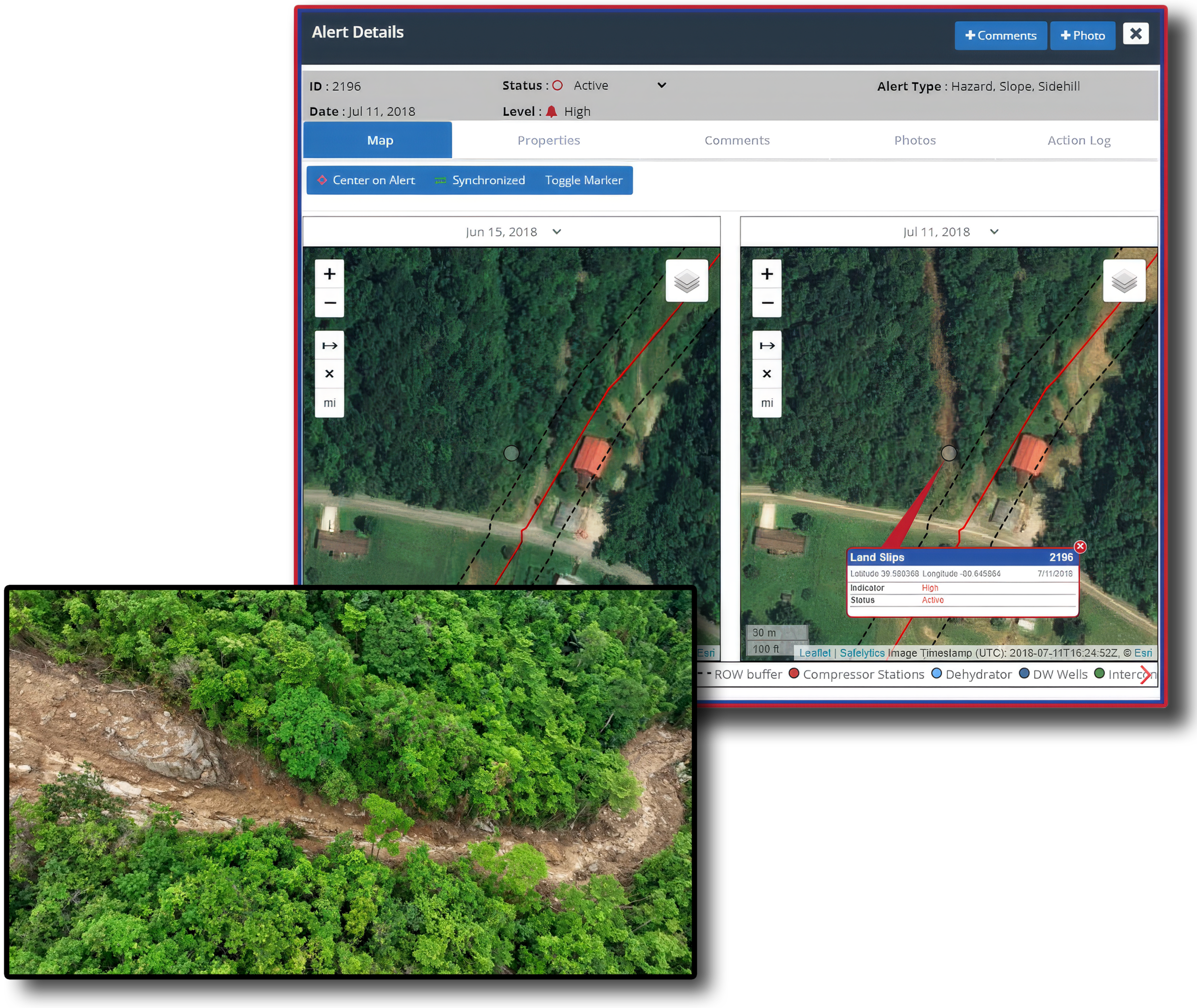
Geohazard Alerts
Landslides and erosion don’t happen instantly; they show warning signs. We track vegetation health and land displacement over time, predicting potential geohazards. Receive early warnings for land slips and shifting terrain so you can reinforce assets before a disruption occurs.
Spill can result in more than $35M in cleanup costs and fines
Pipeline incidents between 2010 and 2024
Incidents per day
Resulted in $9B in cumulative property damage
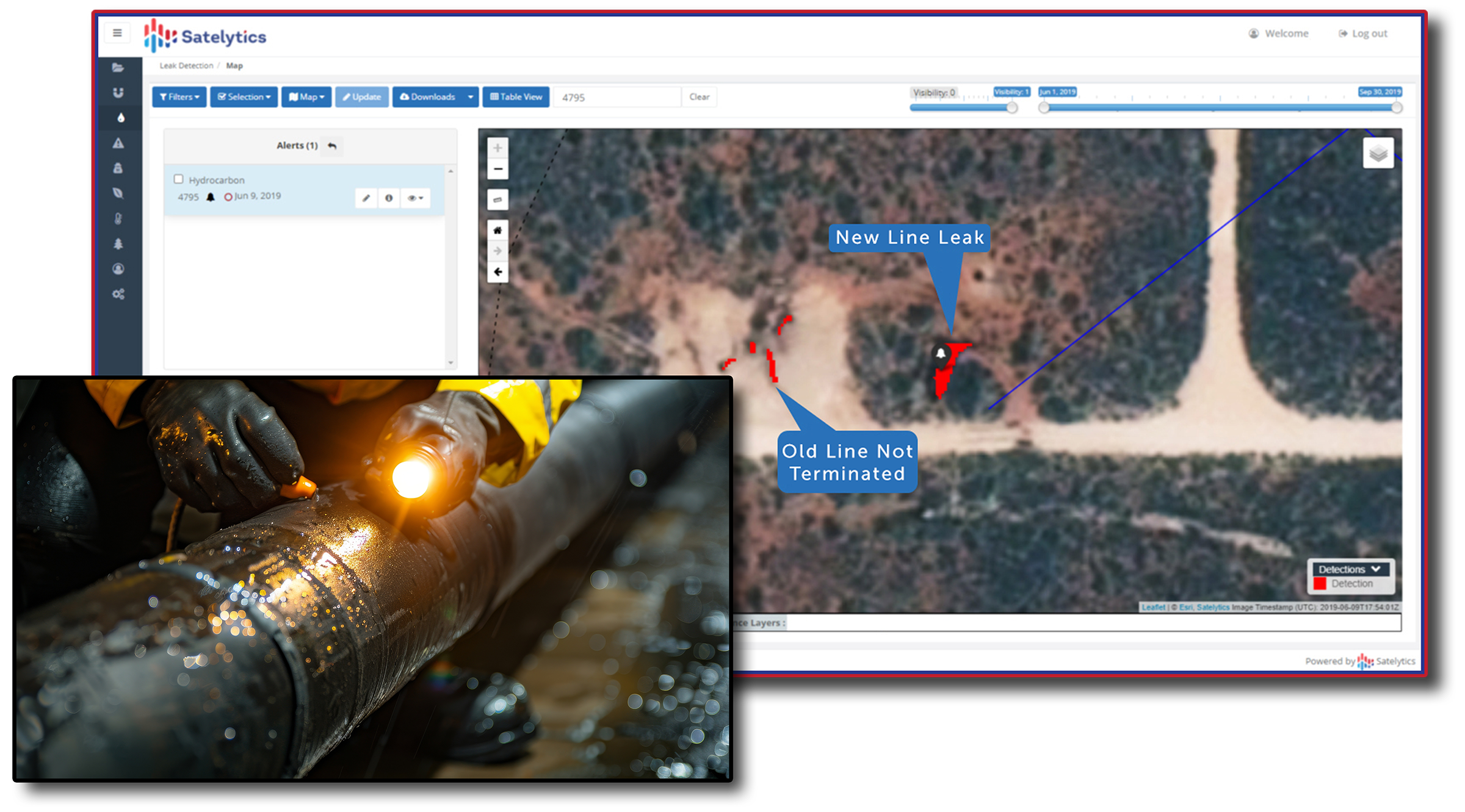
Leak Detection
Detect minute leaks in remote locations. Our algorithms analyze spectral data to find liquid hydrocarbon and produced water leaks that traditional sensors miss. By catching these early, you minimize remediation costs, environmental impact, PR headaches, and lost revenue.”
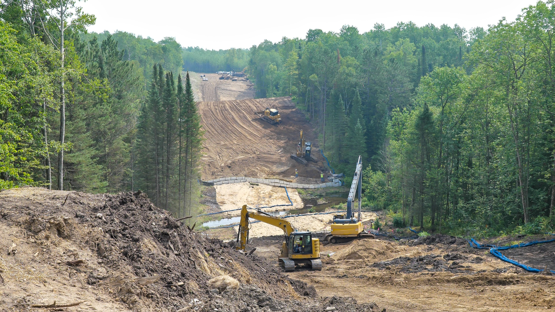
Environmental Compliance
Turn compliance surprises into proof of excellence. Our platform delivers irrefutable, time-stamped evidence of your environmental stewardship.
LEARN HOW CUSTOMERS
HARNESSED SATELYTICS

Prior to your analysis we were restricted to photopoints on the ground. Your results allowed us a lake-wide perspective. Your analysis contributed to our assessment and communications that the water quality of Lake Britton was improved by our deep water release.
Edward Cheslak
Senior Consulting Scientist, Major Western Power Utilities Company
The value clearly comes from finding the leaks...earlier. The inside-driven approach to work scheduling and work planning, the whole efficiency and effectiveness of the work crews is a big part of the value proposition.
Mark Schuler
Utilities Managing Director, Accenture
Satelytics' invaluable analysis of satellite imagery helps us ensure that we are confident in the results. It's a huge cost savings in comparison to field sampling or traditional modeling.
Robin Richards
Principal, Ramboll
I am amazed at the quality and fidelity of the data delivered by Satelytics across our areas of concern. Their technology is unlike anything I've seen at BP. It helped us save a tremendous amount of time and man-hours and gave us a more complete picture than any other data software I've used.
Dr. James Chatham
Technology Specialist in Aqueous Geochemistry, BP
This new technology allows my team and me to automate analysis tasks; we get info quicker which allows us to act on it.
Joshua Beard
GIS Superior, Marathon Pipe Line
Satelytics provides a unique and innovative approach at data analysis. The use of satellite imagery as an analytical tool allows us to peer into the past, evaluate changes over time, and provides cost savings over development of complicated and expensive models.
Maverick James Raber
Manager, Environmental Sciences at Duke Energy
With Satelytics, our clients will be able to optimize their inspection resources and improve their performance in risk management, by having a web tool for constant surveillance of their assets.
Ricardo Alea Uzcategui
Commercial Manager, IT at Tecna Peru
It changes everything. If you're a natural gas distribution company, you can now report your methane emissions near real-time, versus having to rely upon a report that's put together on an annual basis using emission factors. So this allows us to be able to trace our journey in very accountable and transparent terms as we reduce our methane emissions.
Sasha Weintraub
SVP & Chief Commercial Officer,
Duke Energy's Natural Gas Business Unit at Duke Energy
let’s solve your
toughest challenges
Connect with our team to discuss your specific monitoring needs. Our experts will review your operational goals and engage with you to plan how our geospatial solutions can deliver the answers you need.
our intelligence
insights
See how we apply our science to real-world challenges. From detailed case studies to updates on regulatory compliance, explore how our predictive algorithms are solving specific problems in the field today.