
- Problem: Redundant monitoring costs.
- Solution: Collaborate in shared corridors.
- Benefit: ↓ costs per operator, ↑ threat detection, better risk management.
In figure skating, the quadruple Axel is the sport’s ultimate unrealized ambition. It is attempted by only the most daring athletes because the margin for error is nearly nonexistent. Yet those who attempt it do so because the payoff, when mastered, is incomparable. No one wins a championship by playing it safe forever.
The same logic applies to an idea that has circulated through boardrooms and pipeline corridors for years: the shared, basin-wide application of geospatial analytics among competing operators. It was discussed in North Dakota in January 2020, when Bakken Basin producers imagined a collectively monitored basin. It resurfaced in autumn 2023, when Appalachian Basin operators in West Virginia circled the same concept. It keeps coming back because the logic is simply too powerful to ignore.
This is not a pipe dream. It is a financial, environmental, and reputational imperative. The obstacles keeping operators from taking the leap are organizational, not technological.
A Basin Is Not a Solo Instrument
Oil and gas production does not unfold neatly inside property lines. In every major producing basin (e.g., the Bakken, the Permian, the Marcellus-Utica) well pads, gathering lines, tank batteries, and compressor stations of dozens of operators are interwoven within the same geographic footprint. The energy industry spends over $3 billion annually on leak detection alone, yet each operator typically surveys only their own assets, often flying over the same corridors their competitors monitor separately.
This is expensive redundancy in service of incomplete coverage. When assets from multiple operators occupy the same corridors, a single monitoring pass captures risk data relevant to everyone. The foundational question writes itself: why should every company pay to generate data that nature has already co-located?
The Blueprint Already Exists
The closest this industry has come to landing the jump is the intelligent Pipeline Integrity Program (iPIPE). It did not happen because a technology company pushed it. It happened because an operator community was challenged, and then boldly accepted the challenge.
In 2017, North Dakota Governor Doug Burgum set a goal of zero pipeline spills within the state and challenged industry to get there through technological innovation. The response was operator-led. Leaders within the oil and gas industry proposed iPIPE themselves, in direct answer to the governor’s call. Crucially, Governor Burgum’s administration worked in the background, convening conversations, signaling state support, designing creative government support schemes that did not jeopardize industry privacy concerns, and creating the conditions for cooperation without dictating terms to the companies involved.
The results validated the model. iPIPE monitored 1,300 km² weekly across the Bakken, identified more than 200 hydrocarbon and produced water leaks, and earned the IOGCC Environmental Stewardship Award. Member companies stated they entered with low expectations for collaboration but were surprised by the high level of cooperation. Competitors discovered they could work together effectively in non-competitive operational space. By 2020, the consortium had grown to 12 members, including TC Energy, Enbridge, and Energy Transfer.
The structure was elegant in its simplicity: industry ownership, state facilitation, neutral management, and shared costs — with competitive data never once changing hands.
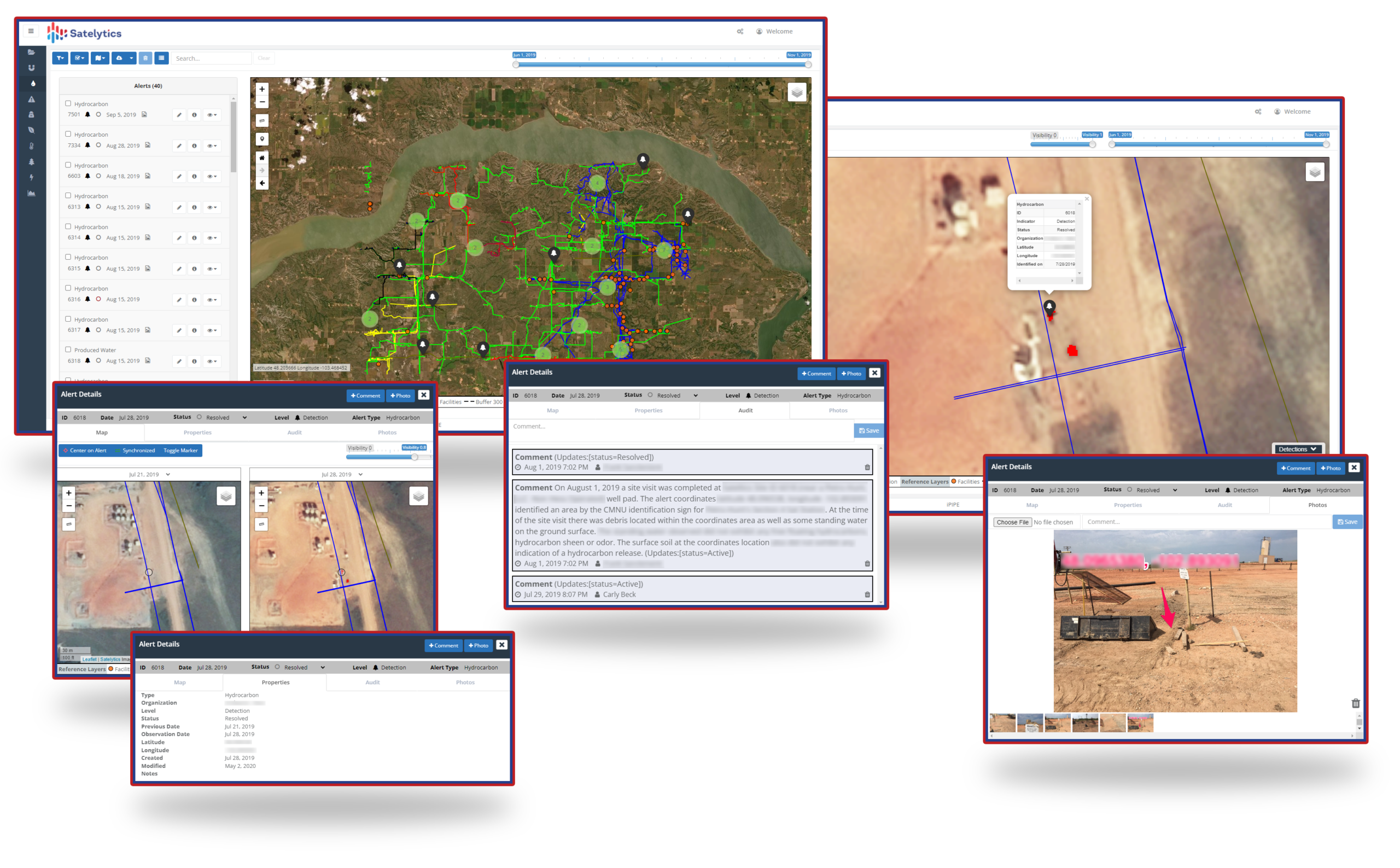
Shared rights-of-way, shared monitoring, shared costs.
Why the Benefits Demand Attention
The case for basin-wide cost-sharing spans the obvious and the underappreciated.
On the obvious side: When 10–15 operators share monitoring costs, individual expenses drop dramatically while detection frequency increases. Organizations implementing comprehensive monitoring programs achieve 50–70% reductions in unplanned outages and 15–25% improvements in resource utilization. Quarterly methane leak detection surveys reduce emissions by 68% compared to annual surveys. Only a shared program makes that frequency economically viable for most operators. Operators who can demonstrate continuous satellite surveillance of their infrastructure also become better neighbors: less landowner friction, stronger community relationships, and more credibility at the easement renewal table.
On the less obvious side, the financial case deepens considerably:
- Insurance. Produced water leaks account for the single largest insurance claims payouts to oil and gas companies. Insurers confirm that companies with advanced leak detection programs qualify for meaningful premium discounts, yet few operators are claiming them.
- Cleanup costs. Average crude oil spill remediation runs approximately $2,000 per barrel, and far higher in sensitive environments. A 500-barrel spill in an average environment carries a $5 million cleanup bill. Detecting a seep at its earliest formation, measured in barrels rather than thousands, transforms monitoring from an expense into a catastrophe prevention investment.
- Litigation. Amplify Energy paid $50 million to settle the class action following its 2021 Huntington Beach pipeline leak. Plains All American’s 2015 Santa Ba99rbara spill generated an estimated $870 million in total incident costs. These are not tail-risk footnotes. They are the documented consequences of detecting incidents too late.
- Regulatory fines. A January 2026 PHMSA enforcement action produced a proposed $9.6 million civil penalty, the largest ever issued in a single pipeline enforcement action. Proactive, documented monitoring is the strongest compliance posture an operator can demonstrate.
- The super-emitter clock. Satellites operated by environmental organizations now identify methane plumes and attempt to attribute them to specific facilities, then publish findings publicly. A March 2026 Earthworks report identified nearly 100 emission events in the Appalachian Basin, naming likely responsible companies, including some with prominent methane reduction pledges. Not knowing first is the most dangerous posture an operator can hold.
This Is Not Competitive Intelligence
The most persistent objection to cooperative monitoring is fear of exposing proprietary information to rivals. It is understandable, but misplaced.
No operator wins or loses market share because a competitor learned they had a seep on Gathering Line 14B. The data generated by GeoAI tools pertains to the physical condition of infrastructure — assets that all operators are already legally required to monitor, maintain, and report on. Production volumes, reserve estimates, pricing strategies, operational efficiencies: none of that is in play.
What is shared (a cleaner environmental record, a documented compliance posture, a lower basin-wide incident rate) benefits every participant equally. This is not a zero-sum game. It is the one arena in the industry where the interests of all operators are genuinely identical: a safer, better-monitored infrastructure that reflects well on the entire sector.
A Challenge to Industry, with Business-Friendly Government Help
North Dakota proved the template. The state did not legislate cooperation or impose a mandate. Governor Burgum issued a challenge, created the conditions for industry to respond, and provided matching financial support through an existing state research program. Operators did the rest.
Texas is arguably even better positioned to replicate that model. The Railroad Commission’s industry-collaborative culture, the success of the Texas Methane & Flaring Coalition (a voluntary alliance of nearly 40 companies that achieved a 50% reduction in Permian Basin methane intensity between 2022 and 2025), and Commissioner Wayne Christian’s explicit preference for “industry-driven solutions, not heavy-handed federal mandates” all point toward a state government that would enthusiastically enable this kind of program without attempting to control it. West Virginia, Ohio, and other Appalachian Basin states with strong oil and gas traditions and business-friendly administrations are equally plausible homes for this initiative.
The specific pathway matters less than the principle it embodies: industry takes ownership, government opens doors and shares costs where it can, a neutral host manages the program, and attorneys from all parties confirm that infrastructure condition data is not, and has never been, the kind of information that defines competitive advantage.
The steps are straightforward:
- Identify a champion operator willing to convene the initial conversation among basin peers.
- Engage the relevant state agency (the Railroad Commission in Texas, the NDIC equivalent in Appalachian states) to signal state support and explore incentivizing mechanisms.
- Select a neutral program manager (a trade association, or a recognized technical organization) to administer the consortium independently.
- Formalize scope in writing with legal review confirming that no competitively sensitive data is shared.
- Run a pilot corridor for six months. Let the results speak. They always do. And companies seem to always need proof in their own backyard.
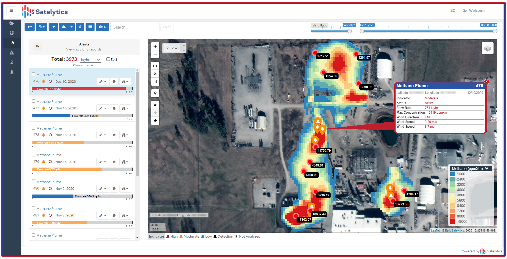
Liquid leaks, methane emissions, land movement, encroachments… none are competitive space.
The Strategic Choice
The pressures are converging from every direction: tightening federal regulations, third-party satellites that will publish what they find regardless of what operators choose to know, ESG scrutiny from investors holding trillions in assets, and the ever-present financial exposure of an undetected spill. The cost of monitoring shared infrastructure independently is becoming economically indefensible. The cost of sharing that monitoring, while keeping competitive data entirely private, grows more compelling every quarter.
The quadruple Axel has been attempted. iPIPE proved it can land. The question now is which basin, which operators, and which governor will step up to write the next chapter.
The technology is ready. The economics are clear. The blueprint exists. The next move belongs to industry.