

- Problem: Monitoring mine operations.
- Solution: Analyze data multiple ways.
- Benefit: Get the whole picture, minimize overlooked risks.
Southeast Asia’s mining boom is a story told in superlatives. Indonesia alone hosts 329 nickel mining concessions feeding the global battery supply chain. Nickel-related land disturbance in the Morowali region alone has already reached roughly 18,167 hectares. But the same superlatives that make headlines about production also make headlines about disaster. In a single week of March 2025, three separate tailings facilities collapsed inside the Indonesia Morowali Industrial Park (IMIP), killing workers and sending a “red wave” of liquified waste into the Bahodopi River, threatening 341 families downstream. Less than a year later, another liquefaction event at the same industrial complex killed an excavator operator. These are not freak accidents. They are the predictable result of monitoring gaps that satellite-based geospatial analytics can close.
Tailings Dams Are Failing in Plain Sight
The forensic pattern behind the incidents at IMIP is well documented: tailings deposited using “upstream” construction methods resulted in liquefaction accelerated by Indonesia’s combination of monsoon rainfall and seismic activity.
Excess moisture is the common thread behind nearly every catastrophic tailings failure, and it is exactly the kind of signal that high-resolution multispectral satellite imagery is built to identify. A retrospective analysis of the 2019 Brumadinho tailings dam collapse in Brazil, which killed 259 people, found failure was preceded by visible surface changes that multispectral imagery had been tracking for nearly a decade.
Satelytics analyzes 30 cm resolution NIR and RGB satellite imagery to observe changes across a tailings dam’s surface that indicate rising risk of failure, including: seepage staining on embankment faces, expanding wet zones and decant pond geometry, vegetation stress or die-off caused by phreatic water intrusion, and shifts in the crest and slope geometry itself. One set of imagery resolves individual seepage points, wet-face staining patterns, and localized vegetation stress with a level of spatial detail that lower-resolution moderate-resolution sensors cannot match, giving operators a persistent, image-based early-warning layer across a portfolio of dams that a periodic site walk simply cannot replicate.
Reclamation Promises Rarely Match Reclamation Reality
Every mining permit in Indonesia and Malaysia comes bundled with a reclamation obligation. In Morowali, total mining-related land disturbance stood at roughly 18,167 hectares as of 2025. Of the roughly 12,272 hectares of tropical forest lost to mining, independent satellite analysis found only about 3% showing signs of vegetation regrowth by 2023.
Regulators are starting to notice. Companies that cannot produce satellite-verifiable proof of vegetation regrowth, canopy height, and species composition on their reclamation acreage are exposed to exactly this kind of enforcement action, along with the reputational fallout of reports documenting a “twenty times more land deforested than rehabilitated” ratio.
Satelytics’ vegetation health, height, and speciation algorithms give operators a defensible, third-party record of what is actually growing back versus what is merely claimed on a permit renewal form. That distinction matters enormously to regulators skeptical of “reclaimed” figures. Monitoring that can distinguish native species regrowth from fast-growing exotic filler species planted purely to satisfy a Reclamation Guarantee Fund checkbox is not a nice-to-have. It is the only way to know whether reclamation happened at all.
Chemical Contamination Does Not Wait for a Lab Report
Acid mine drainage (AMD) is chemistry doing exactly what chemistry does: exposed sulfide minerals oxidize on contact with water and air, producing acidic runoff (commonly below pH 4.5) laced with dissolved iron, manganese, and heavy metals. Indonesian coal operations have documented this repeatedly. One study of a Jambi province coal mine found neutralizing a single sump pit’s AMD required 30,240 kilograms of lime over 21 days of continuous liming. That is an enormous, recurring operating cost triggered by a chemical process that starts long before it shows up in a compliance sample.
Malaysia’s bauxite sector offers an even starker cautionary tale of what happens when soil and water chemistry monitoring lags reality. During the 2015-16 Kuantan bauxite disaster, unregulated washing and stockpiling operations turned rivers and 15 kilometers of Pahang coastline red with heavy-metal-laden sediment. Treated drinking water supplies in Semambu and Bukit Goh were found non-compliant for lead and aluminum, respectively. The disaster forced a moratorium and the revocation of licenses for 34 contractors, but by then a marine biologist was warning the affected coastline could remain a “dead zone” for up to three years.
Satelytics’ soil and water chemistry algorithms detect the spectral signatures of leaching, elevated turbidity, and heavy-metal-bearing sediment plumes as they move through a watershed, not weeks later when a downstream fishing community notices the water has turned red. For operators managing sulfide-bearing overburden or bauxite stockpiles across dozens of sites, satellite-based chemistry monitoring converts a reactive, sample-by-sample compliance posture into continuous surveillance across an entire concession and its downstream waterways.
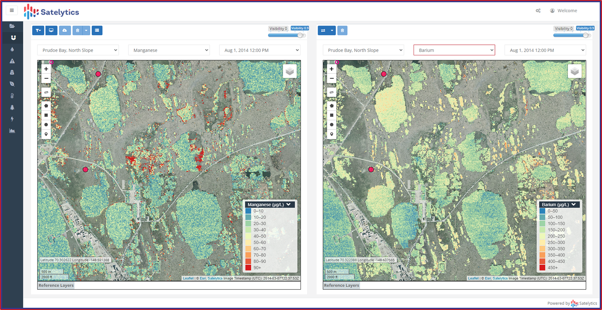
Metals concentrations in water bodies near mining activities.
Illegal Mining on Your Concession
Encroachment is the quietest of the four risks discussed here and, in Southeast Asia, one of the most persistent. In June 2026, Malaysian authorities arrested nine people and seized RM3.75 million (roughly USD 800,000) worth of equipment and bauxite in a raid on an illegal mining operation hidden inside a Felda plantation lease near Kuantan. That operation reportedly went undetected for more than a year, in part because trucks hauling ore avoided roads that would have exposed them to routine patrol. It was not an isolated case: a separate corruption investigation found illegal bauxite extraction had been occurring at the same general area, Felda Bukit Goh, since 2022.
In Indonesia, the encroachment problem operates at industrial scale. One nickel operator, in a well-publicized criminal case, mined a 20,000-hectare area for five years, from 2010 to 2015, before its permit was even issued. Thousands of companies nationwide have been cited for mining without proper forest release permits or reclamation compliance.
Every one of these encroachments left a visible signature in satellite change-detection data well before ground enforcement caught up. Third-party encroachment onto a mining lease is not just a legal liability for the concession holder; it is lost revenue, unaccounted-for resource depletion, and an environmental and safety exposure the legitimate operator gets blamed for regardless of who caused it. Satelytics’ change detection algorithms flag unauthorized clearing, unpermitted excavation, and unrecognized vehicle or equipment activity across a concession boundary automatically, turning encroachment detection from an annual site visit into a standing, always-on perimeter.
Four Risks, One Vantage Point
Land movement, vegetation health, water and soil chemistry, and encroachment are typically managed by four different teams within a single company, using four different tools. Satelytics collapses that fragmentation into a single, continuously updated view of a mine’s entire operational and environmental footprint, built on one consistent data source: high-resolution multispectral satellite imagery. That data source does not wait for the next dry-season site visit, the next lab report, or the next viral video of a landslide to reveal what has already gone wrong.
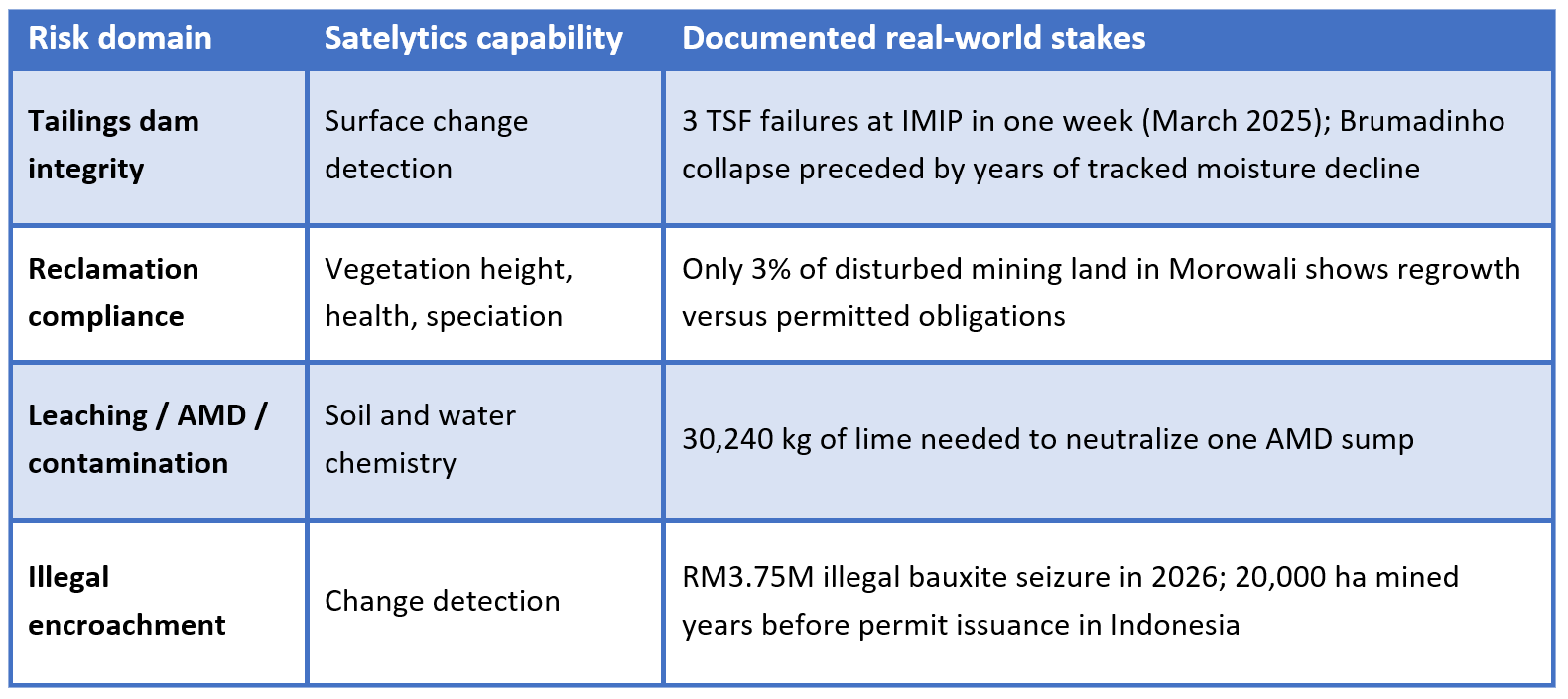
For mining operators across Indonesia and Malaysia navigating tightening regulatory scrutiny, community backlash, and an unforgiving monsoon-and-seismic operating environment, the choice is no longer between satellite monitoring and status quo. It is between finding these problems from orbit, on your own schedule, or finding them in a surprise headline.
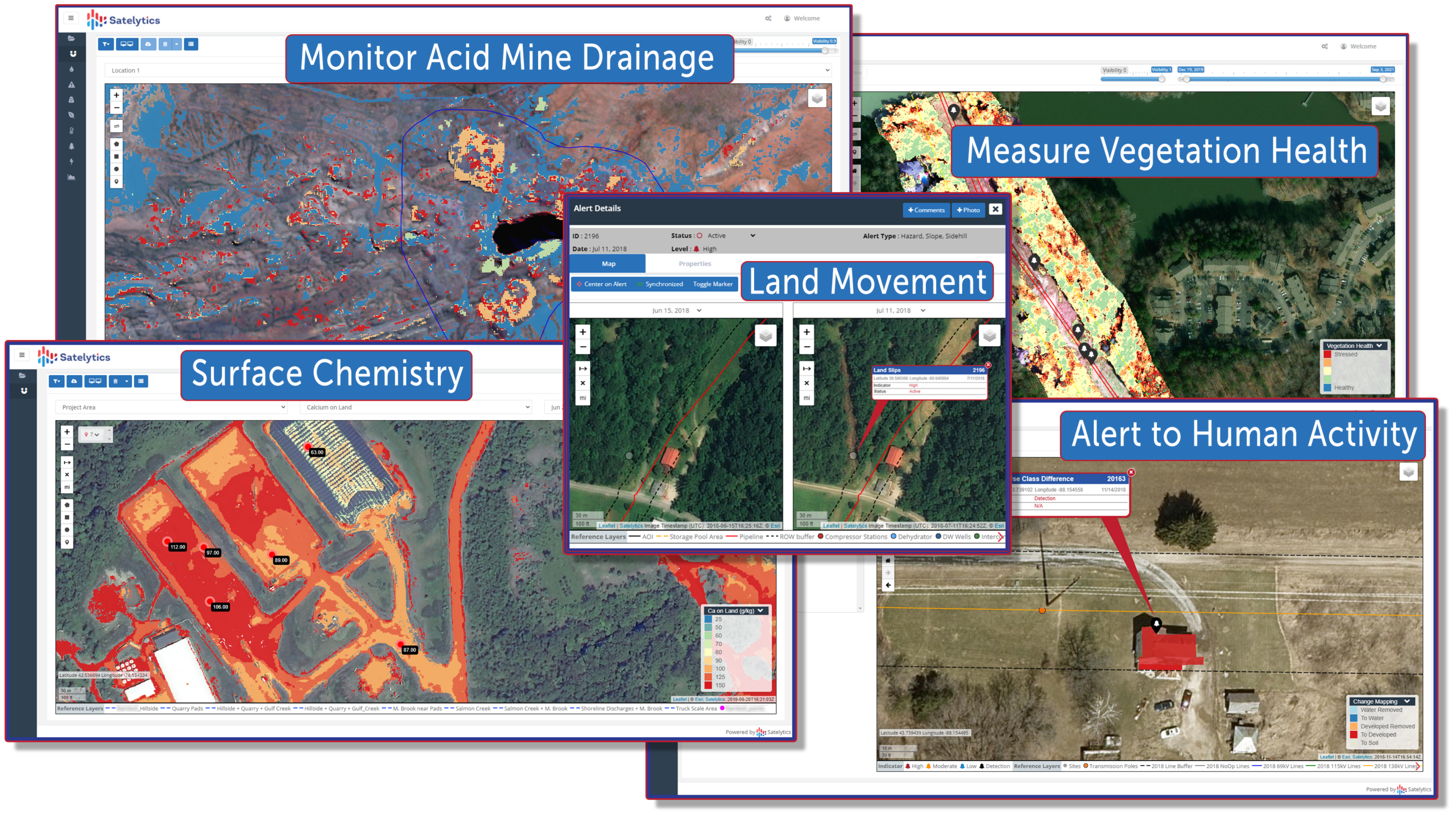
Satelytics offers a variety of measurements relevant to mining.