
- Problem: Reactive vegetation management.
- Solution: Condition-based intelligence.
- Benefit: Lower costs, fewer outages, reduced risk.
Imagine it’s a Tuesday morning in October. A vegetation management supervisor at a regional Distribution Network Operator (DNO) is reviewing last quarter’s arboricultural contractor invoices. Line items for cutting, clearing, and storm-response callouts add up to millions of pounds. The frustrating part? She suspects the crew spent a significant share of its hours on spans that didn’t need intervention and missed two corridors that did. Come the next Atlantic storm, those two corridors will make the local news.
This scenario is not hypothetical. It is the operational reality for DNOs across Great Britain, and it is why forward-thinking network leaders are asking a larger question: What if vegetation management wasn’t just a maintenance programme, but a strategic intelligence capability?
The Stakes Are Higher Than Your Budget Line
The numbers demand attention. Scottish and Southern Electricity Networks (SSEN) alone invested a record £25 million in a single year on overhead network maintenance across central southern England and committed a further £25 million in 2025. Multiply that investment profile across the six DNO groups serving Great Britain, and the aggregate spend on vegetation-related network maintenance runs into hundreds of millions of pounds annually.
Yet despite this investment, vegetation contact with overhead lines remains one of the primary drivers of Customer Interruptions (CIs) and Customer Minutes Lost (CMLs) — the two metrics at the heart of Ofgem’s Interruptions Incentive Scheme (IIS). Under the RIIO-ED2 price control (running from April 2023 to March 2028), DNOs face direct financial penalties for missing their IIS targets, with the sector accumulating cumulative net penalties of £50.9 million in the scheme’s first two years. That figure is not a compliance cost. It is a quantified consequence of reactive rather than intelligence-led network management.
The cost exposure extends well beyond the IIS. Since Ofgem revised its severe weather compensation regulations following its review of the Storm Arwen response, the maximum compensation payable per customer has risen from £700 to £2,000. Storm Arwen itself (where most network faults were caused by trees and branches falling onto overhead lines) saw DNOs pay out £44 million in total compensation and left nearly one million homes without power across Great Britain in November 2021. When a single storm event can cost the sector tens of millions in payments alone, the value proposition for continuous vegetation intelligence becomes unambiguous.
The broader economic exposure is equally compelling. Research commissioned by the Royal Academy of Engineering and Ofgem has estimated the societal cost of energy not supplied (SCENS) in Great Britain ranges from approximately £4,300/MWh for a one-minute interruption to over £8,100/MWh for a three-hour outage. For DNOs serving dense population centres or critical industrial loads, every unplanned outage carries an economic penalty that extends far beyond their own balance sheet.
GeoAI: From Monitoring to Intelligence
GeoAI is the integration of artificial intelligence with satellite imagery, spatial data science, and multi-spectral sensor technology. For utility vegetation management, it represents a fundamental shift: from scheduled, labour-intensive field cycles to condition-based, satellite-informed intelligence delivered directly to planning and dispatch teams.
UK Power Networks (UKPN) has already explored this direction through its “Satelline” innovation project, which tested satellite remote sensing as an alternative to the LiDAR aircraft surveys that currently underpin vegetation proximity assessments across its overhead network. LiDAR scans, while effective, are typically conducted on two- to three-year cycles, are costly, produce greenhouse gas emissions from survey aircraft, and cannot deliver the near-continuous monitoring that a weather-intensified growing season demands.
Satelytics applies GeoAI to analyse vegetation encroachment, tree health, species identification, and growth trajectories across entire network corridors, at a fraction of the cost of equivalent ground-based or airborne assessment. The result is not more data — it is the right data, delivered as actionable alerts: this corridor, this span, this tree presents elevated risk. Your crews go where it matters, when it matters.
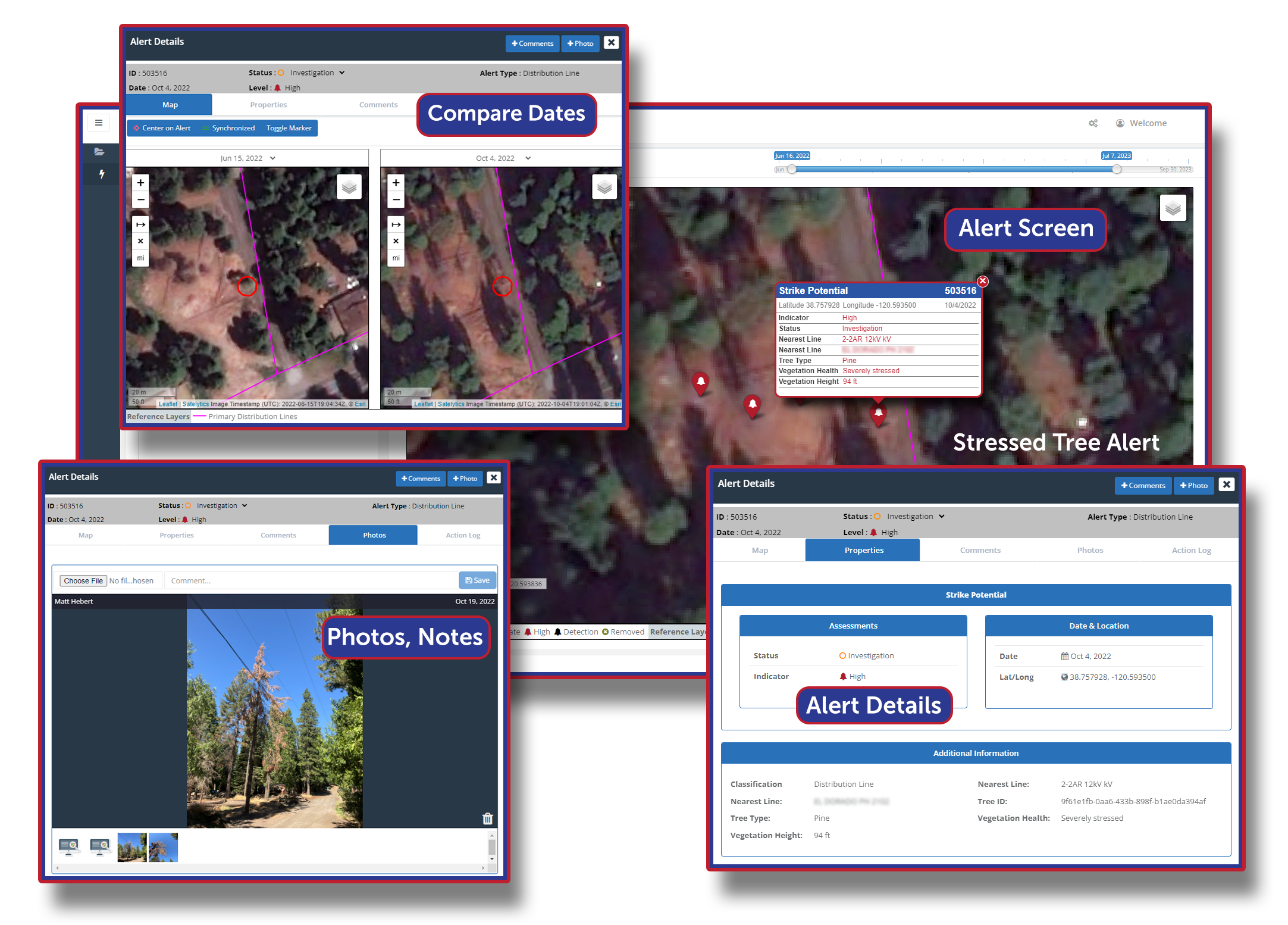
Guide your crews to the problem, when it matters.
The operational implications are significant. By enabling condition-based prioritisation, DNOs can plan vegetation work years in advance, redirect field resources to the highest-risk segments, and reduce the windshield time that consumes crew hours without producing outcomes. SSEN’s own experience illustrates the potential: by improving the targeting of its 84-strong arboricultural team, it increased maintenance coverage from 33,678 spans in 2023/24 to 41,981 spans in 2024/25 — a 25% improvement in throughput at equivalent investment. The same satellite pass that identifies encroachment risk can also verify whether contractor work was performed as invoiced, closing a transparency gap that costs networks millions in unchecked billing.
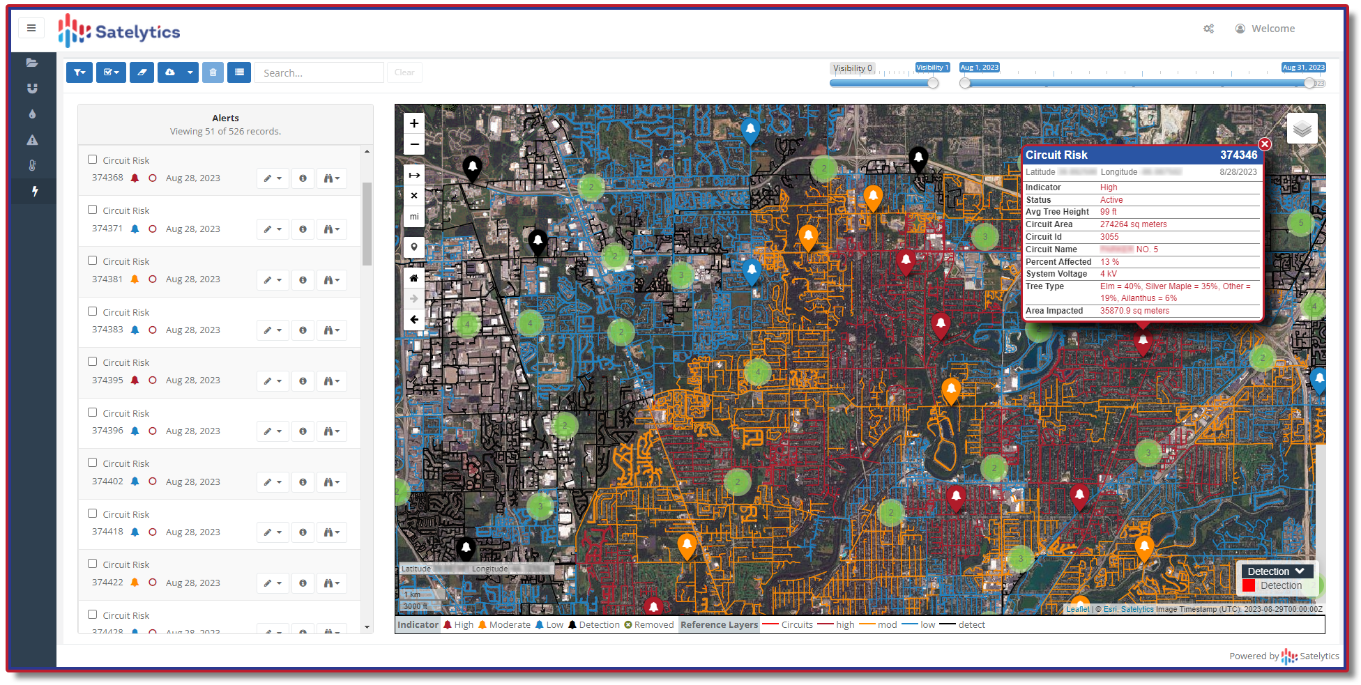
Stop reacting, start planning vegetation work years in advance.
The Regulatory and Commercial Imperative
Here is where the conversation must expand beyond the vegetation manager’s desk.
Under RIIO-ED2, DNO performance on CIs and CMLs is directly tied to financial reward and penalty. Several DNO groups, including Northern Powergrid (NPg) and SSEN’s SSES region, are in persistent penalty territory, each incurring IIS penalties of £7–9 million in 2024/25 alone. With the upcoming RIIO-ED3 price control (April 2028 to March 2033) on the horizon, Ofgem has signalled its intent to drive further performance improvements for consumers. The trajectory of regulatory ambition is clear: targets will tighten, and the networks that rely on fixed-cycle vegetation programmes will find the penalty arithmetic increasingly unforgiving.
Beyond the IIS, the UK’s regulatory and statutory landscape creates a layered set of obligations that intelligent vegetation data can help DNOs navigate:
- Electricity Act 1989, Schedule 4, Paragraph 9 — the statutory framework under which licence holders may direct landowners to fell or lop trees in proximity to electric lines or plant. GeoAI-derived encroachment data provides the evidence base to prioritise and substantiate Schedule 4 notices, and to track compliance.
- Guaranteed Standards of Performance (GSoP), Electricity (Standards of Performance) Regulations 2015 — automatic compensation payments apply when customers lose supply due to faults. Proactive vegetation intelligence reduces the number of qualifying events before they occur.
- Environment Act 2021 and mandatory 10% Biodiversity Net Gain (BNG) — all major network projects in England must now demonstrate a minimum 10% BNG, with habitats secured for at least 30 years. The same satellite dataset that monitors vegetation risk can simultaneously quantify habitat quality, support ecological survey planning, and document biodiversity outcomes across managed Right-of-Way (ROW) corridors.
- RIIO-ED2 Environmental Output Delivery Incentives (ODIs) — DNOs are assessed against Business Carbon Footprint, SF₆ emissions, and fluid-filled cable leakage targets. In 2024/25, 12 of 14 DNOs missed at least one environmental ODI target. GeoAI-supported Integrated Vegetation Management (IVM), which establishes stable, low-growing plant communities in ROW corridors, reduces herbicide volumes, lowers mowing frequency, and supports measurable carbon footprint reductions.
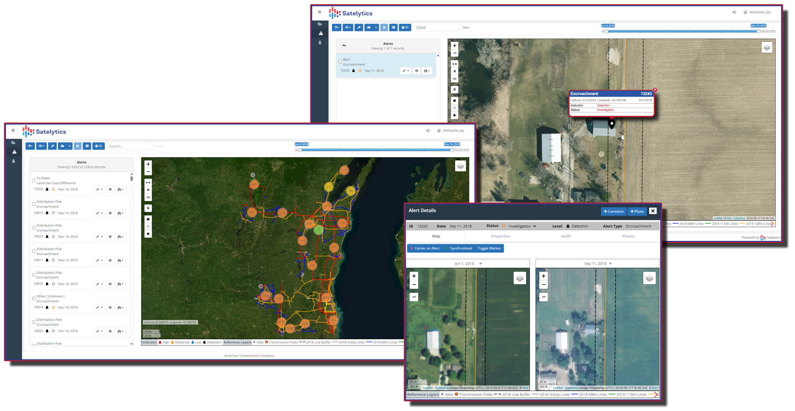
Detect encroachments, intrusions, land movement, and other liability risks.
A Single Dataset, Multiple Strategic Returns
The vision goes further than cutting fewer trees more intelligently. The same satellite dataset monitoring a DNO’s vegetation canopy can simultaneously:
- Detect encroachments — unauthorised activity, land movement, or third-party intrusions on ROW corridors that create both safety risk and liability exposure under the Electricity Act
- Support storm damage assessment — enabling rapid, spatially precise recovery response rather than systematic patrols of entire licence areas after major weather events, of the kind that drew Ofgem criticism following Storm Arwen
- Inform asset investment planning — a growing body of evidence shows that between 50 and 75 percent of poles damaged during Storm Arwen were over 40 years old, suggesting that vegetation risk intersects with asset condition risk in ways that a single geospatial dataset can help reveal
- Feed RIIO reporting and stakeholder disclosure — quantifying biodiversity outcomes, habitat restoration, and environmental stewardship across managed ROW acreage to satisfy Ofgem, investor, and ESG expectations
This is not a technology experiment. It is an enterprise intelligence platform where a single geospatial dataset simultaneously drives operational efficiency, IIS performance, regulatory compliance, environmental ODI delivery, and risk reduction across an entire licence area.
From Pixels to Strategic Posture
Satelytics was built on a simple but powerful conviction: the value of geospatial data is not in the imagery; it is in the intelligence derived from it. Every satellite pass is an opportunity to move from reactive to proactive, from fixed cycles to condition-based precision, and from siloed contractor invoices to enterprise-wide insight.
For UK DNOs, the question is not whether GeoAI pays for itself (a 20% reduction in vegetation-caused power cuts, as SSEN has demonstrated with intensified targeted investment, begins to quantify the return). The question is whether your organisation is ready to capture it systematically, at scale, and ahead of the RIIO-ED3 framework that will define the performance benchmarks of the next decade.
The trimming cycle was always a workaround for the absence of better information. That information is now available. Britain’s networks have the regulatory incentive, the statutory framework, and the operational need to use it.