
- Problem: Small leaks get expensive quickly.
- Solution: Detect leaks too small for other methods.
- Benefit: Investigate and respond earlier, limiting your financial liability.
Satelytics detects liquid hydrocarbon and produced water leaks, distinguishes between them, and directs operators to locations that need attention. Our satellite-based analytics provide another way to find releases across gathering lines, pipeline rights-of-way, and associated facilities, including places crews do not visit every day.
The results are practical: more than 25 confirmed liquid leaks identified in one operating program, a customer-reported 13-day advantage over traditional monitoring in another example, and at least $500,000 in estimated savings from an early brine detection at a remote site. These are reasons to take a closer look at what additional visibility could mean for your pipelines.
Find Oil by Its Signature
A satellite image contains more than a recognizable view of the ground. Different materials reflect light differently, including at wavelengths outside human vision. Satelytics applies AI-powered spectral analysis to those differences to identify liquid hydrocarbons and produced water on the surface. The analysis turns imagery into an alert tied to a specific location.
For hydrocarbon pipelines, that means looking for the surface expression of a release rather than waiting for an internal monitoring system to register a change. Satelytics has calibrated and tested its crude oil and produced water algorithms over multiple seasons in the Williston Basin, including gathering systems and well pads.
This adds an independent view of pipeline performance. Internal systems monitor what is happening inside the network; satellite analytics look for evidence of what has escaped it. The two approaches can work together, with field verification establishing what happened and what response is needed.
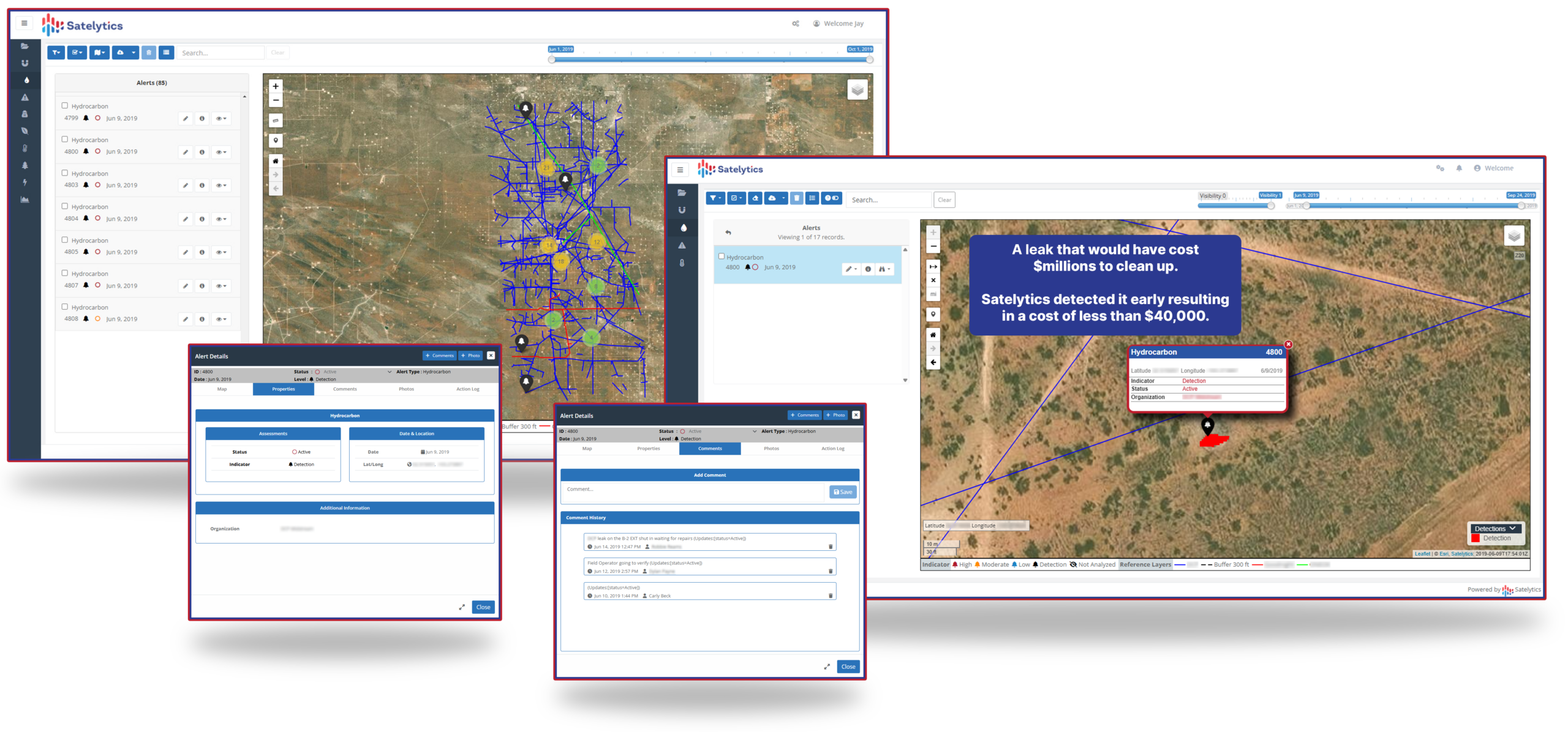
Catch hydrocarbon leaks before they put a huge dent in your budget.
Find Brine Without a Pool
Produced water presents a different detection problem, and Satelytics treats it differently. Its algorithms look for spectral signatures associated with chlorides and other constituents of the saline fluid. They distinguish produced water from ordinary rainwater and snowmelt, helping operators separate a suspected release from an otherwise unremarkable wet area.
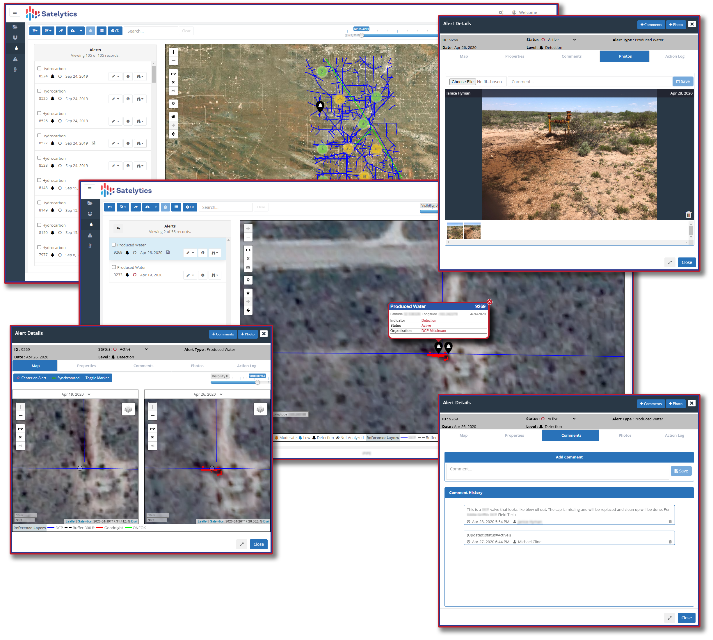
Identify produced water leaks and distinguish them from hydrocarbon leaks.
A visible pool is not required. Brine that has wetted exposed soil or well-pad gravel can leave a detectable signature. This matters because a release does not have to collect neatly beside a pipe to warrant attention. Satelytics can identify evidence on the surrounding surface and point crews toward the area that needs investigation.
Knowing which liquid is present gives an investigation a more useful starting point. A suspected hydrocarbon release and a produced water signature call for attention to different materials, even when both appear along the same corridor. The purpose is not merely to flag a change in the landscape; it is to help explain why that change deserves a closer look.
Winter does not eliminate that capability. Customer-confirmed detections include produced water against a snow background, diluted brine mixed with snowmelt, and hydrocarbons on winter land surfaces. In one instance, early discovery helped keep the fluids confined to the well pad, reducing remediation work.
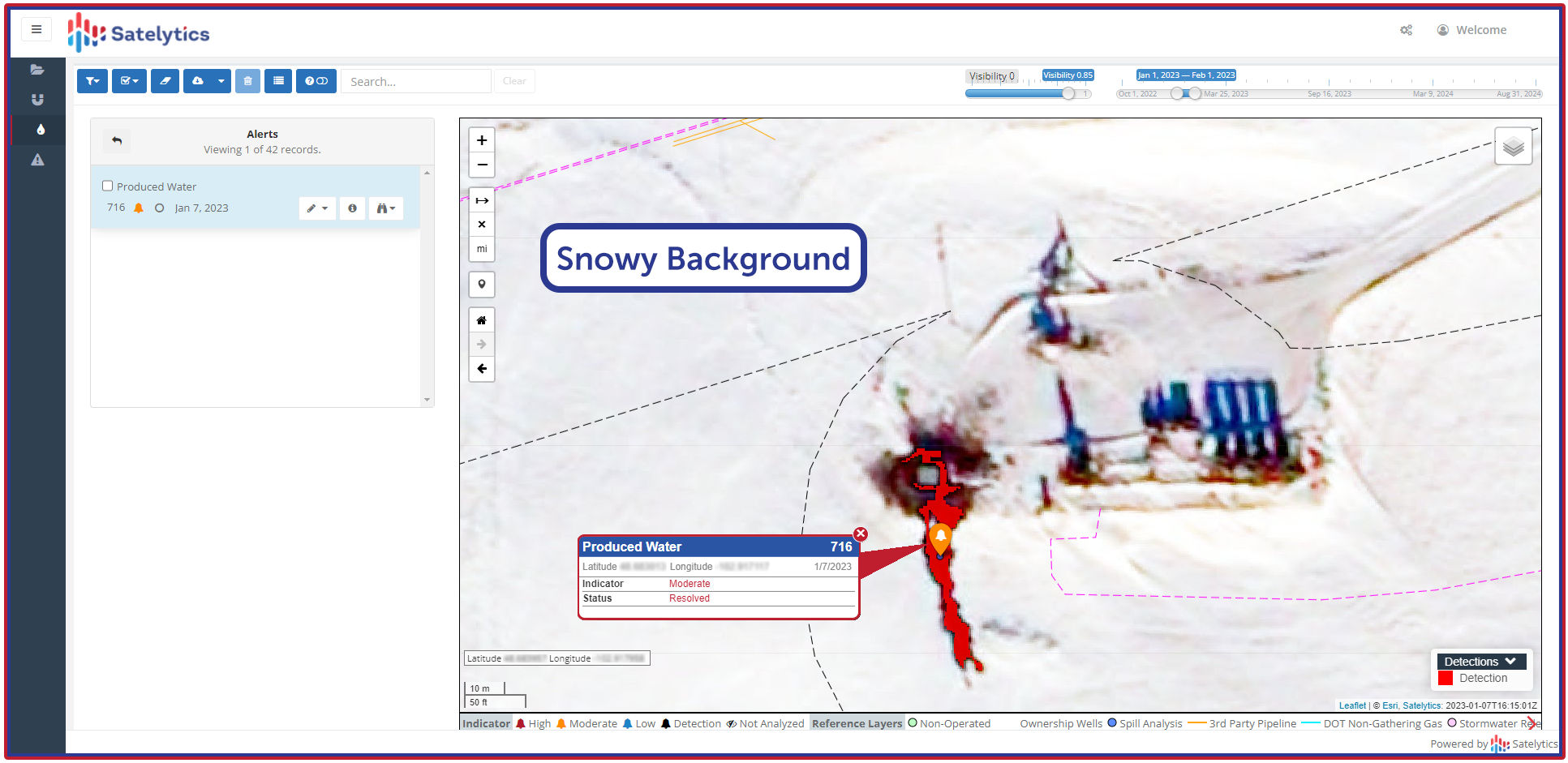
Spot leaks, even against a snowy background.
Working Across an Entire Network
In North Dakota, one operator has used Satelytics since 2022 to monitor more than 3,000 square miles and more than 1,200 miles of pipeline on a weekly schedule. The coverage includes well pads and compressor stations as well as the lines connecting them. More than 25 liquid leaks have been identified and confirmed through the program.
The operator adopted that broader view after a failure released approximately 34,000 barrels of produced water over nearly a month before discovery. Cleanup costs exceeded $20 million. The company added weekly satellite monitoring across its North Dakota operations to help avoid a repeat.
Since then, the program has found small leaks and seepages, often before field personnel or SCADA data revealed an anomaly. Satelytics reports that multiple regulatory leak submissions name it as the identifying agent. The monitoring has continued under new ownership following the operator’s acquisition.
The significance is not simply the size of the area covered. It is the ability to apply the same analytical attention across that area, repeatedly, and turn a suspected release into a location someone can check. For an operator managing dispersed assets, that connects broad coverage with a focused field response.
Send Crews to the Problem
Satelytics delivers alerts with location coordinates, asset identification, and severity ratings. Those details help integrity teams decide where to investigate and how to prioritize the work. Operators receive findings they can act on rather than a new assignment to search through satellite images.
Results can arrive within hours of satellite data capture. The monitoring schedule is a separate consideration: the North Dakota program uses weekly observations, while other customers monitor multiple times per week. The right combination of coverage and frequency should reflect the assets being watched and the operator’s response needs.
For the field team, the workflow is straightforward: receive the alert, investigate the location, confirm the finding, and respond. Satellite analytics supply another source of evidence within that process; they do not require abandoning existing monitoring or established operating procedures.
This is also a useful way to evaluate the service. Ask what an alert would show for your assets, who would receive it, and how a crew would use it. The value becomes clearer when the discussion moves from what a satellite can see to what your team can do with the result.
What Earlier Discovery Can Mean
One customer told Satelytics that a leak alert arrived 13 days before its traditional monitoring methods would have found the problem. That estimate captures the benefit in plain terms: more time to investigate and intervene before a release grows.
At a separate remote facility, Satelytics detected brine mixed with snowmelt outside the site’s boundaries. The location had little history of operational problems and was not visited regularly. The customer estimated that early discovery saved at least $500,000 and credited Satelytics when reporting the spill to North Dakota regulators.
Those examples give operators a concrete starting point for the financial discussion. Compare the cost of additional monitoring with the consequences of a release remaining undiscovered on your network. Consider cleanup, product loss, access, and response; not just the price of collecting imagery.
Put Your Pipelines in View
Satelytics detects both liquid hydrocarbons and produced water across operating pipeline networks. The real question is where that capability could add the most value to your own network. Start with gathering lines, remote facilities, or pipeline corridors where an additional source of early warning would make a meaningful difference.
Bring your asset footprint and current monitoring approach. Ask to see relevant leak detections, review coverage and acquisition frequency, and walk through how an alert reaches the people responsible for responding. Build the discussion around finding and confirming releases—not simply adding another technology.
Contact Satelytics at sales@satelytics.com to review your liquid hydrocarbon and produced water pipelines. Find out what an additional detection layer could reveal before your next leak becomes your next major cleanup.