
- Problem: Reactive vegetation management.
- Solution: Condition-based intelligence.
- Benefit: Lower costs, fewer outages, reduced risk.
Imagine it’s a Tuesday morning in August. A vegetation management supervisor at a mid-size regional utility is reviewing last quarter’s contractor invoices. Line items for trimming, clearing, and emergency response add up to millions. The frustrating part? She already suspects the crew spent 40% of its field hours on circuits that didn’t need it and probably skipped two corridors that did. Next month, those two corridors will make the local news.
This scenario is not hypothetical. It’s the operational reality for utilities across the country, and it’s why the smartest minds in the industry are asking a bigger question: What if vegetation management wasn’t just a maintenance program, but a strategic intelligence capability?
The Stakes Are Higher Than Your Budget Line
The numbers are worth a pause to consider. U.S. utilities collectively spend an estimated $6–8 billion annually on vegetation management, yet nearly one-quarter of all power outages are still attributable to vegetation contact. The Department of Energy estimates power outages cost the national economy $150 billion every year. When the January 2025 Los Angeles wildfires burned through communities, the toll reached $65 billion in total damage. Looking a bit further back Nearly as recently, powerline failures have been responsible for approximately 19% of acres burned in California between 2016 and 2020.
The arithmetic is unforgiving: even utilities spending $100 million or more per year on vegetation management are losing far more when those programs run on fixed cycles, incomplete data, and reactive dispatch. An industry study found that improved vegetation management can reduce storm-related tree damage by as much as 63%, and data-driven approaches can reduce outages by 30% while cutting vegetation management costs by 20%. The question is no longer whether technology pays for itself. It’s whether you can afford to wait.
GeoAI: From Monitoring to Intelligence
GeoAI is the integration of AI with satellite imagery, spatial data science, and multi-spectral sensor technology. For utility vegetation management, it represents a fundamental shift: from scheduled, labor-intensive field cycles to condition-based, satellite-informed intelligence delivered directly to your planning and dispatch teams.
Satelytics applies GeoAI to analyze vegetation encroachment, tree health, species identification, and growth trajectories across entire rights-of-way, at a fraction of the cost of equivalent ground-based assessment. The result isn’t more data. It’s the right data, delivered as actionable alerts: this corridor, this span, this tree presents elevated risk. Your crews go where it matters, when it matters.
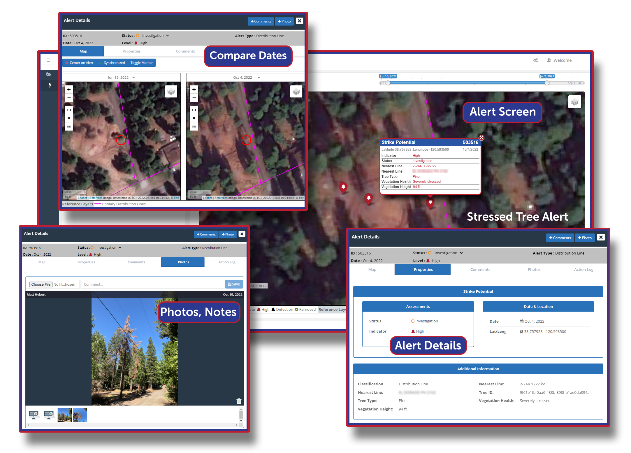
Guide your crews to the problem, when it matters.
The operational implications are significant. By enabling condition-based prioritization, utilities can plan vegetation work years in advance, redirect field resources to highest-risk segments, and reduce the windshield time that consumes crew hours without producing outcomes. Critically, the same satellite pass that identifies encroachment risk can also audit whether contractor work was performed as invoiced, thus closing a transparency gap that costs utilities millions in unchecked billing.
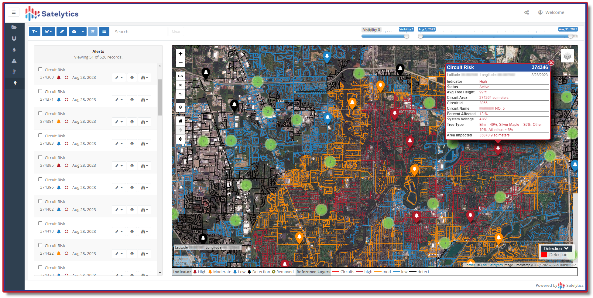
Stop reacting, start planning vegetation work years in advance.
The Regulatory Horizon Is Not Optional
Here is where the conversation needs to expand beyond the vegetation manager’s desk.
Integrated Vegetation Management (IVM) programs consistently outperform single-method programs on both cost and reliability. A 20-year present-value analysis comparing IVM treatment cycles with repeated mechanized mowing found that IVM programs reduced total maintenance costs by 25% to 57%. That’s a compelling capital planning story.
GeoAI strengthens every pillar of IVM. Remote sensing provides the early-detection intelligence that lets biological and chemical controls be deployed precisely, preventing regrowth suppression from becoming a reactive, broadcast-application problem. It allows utilities to establish stable, low-growing plant communities in ROW corridors, which means fewer mechanical visits, lower herbicide volumes, and better long-term cost trajectories.
But the vision goes further. The same satellite dataset monitoring your vegetation canopy can simultaneously:
- Detect encroachments — unauthorized activity, land movement, or third-party intrusions on ROW corridors that create liability exposure and asset risk
- Identify wildfire risk zones — flagging high-fuel accumulation areas before dry-season ignition windows open, supporting the wildfire mitigation plans now required in nine states
- Support post-storm damage assessment — enabling rapid, spatially precise recovery response instead of systematic patrols of entire service territories
- Feed ESG and regulatory reporting — quantifying biodiversity outcomes, habitat restoration, and environmental stewardship across managed ROW acreage to satisfy investor and regulatory expectations
This is the “all of the above” approach. It doesn’t replace your vegetation managers or your field crews. It gives every part of your program a common operating picture — one that serves operations, compliance, finance, and executive stakeholders simultaneously.
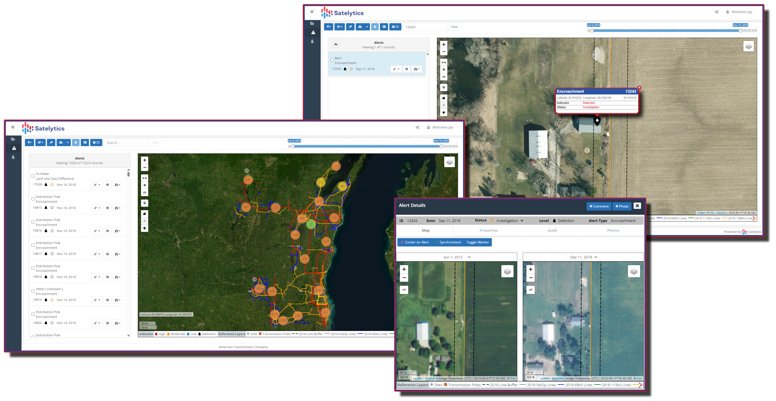
Detect encroachments, intrusions, land movement, and other liability risks.
The Corporate Challenge Behind the Canopy
Senior utility leaders face a set of pressures that extend well beyond tree trimming compliance. NERC FAC-003-5, which took effect in April 2024, updated mandatory transmission vegetation management standards for all registered Transmission and Generator Owners. Nine states now mandate comprehensive wildfire mitigation plans, with six of those passing new legislation in 2025 alone. Insurance carriers are fundamentally reassessing exposure management for utilities in wildfire-exposed territories. The quality of your mitigation data is increasingly central to coverage decisions.
Meanwhile, 74% of business customers experienced some form of power outage in 2025, with average outage durations reaching 22 hours in some regions, and 25% of businesses reporting direct financial setbacks. Customer satisfaction scores track closely with outage frequency and duration, and in competitive or rate-regulated environments, those scores carry regulatory and reputational weight.
The utility leader who approaches vegetation management as a narrow O&M line item is leaving strategic value on the table. The one who treats it as an enterprise intelligence platform where a single geospatial dataset simultaneously drives operational efficiency, regulatory compliance, ESG performance, and risk reduction across the entire service territory, is positioned to lead the next chapter.
From Pixels to Strategic Posture
Satelytics was built on a simple but powerful conviction: the value of geospatial data is not in the imagery — it’s in the intelligence derived from it. Every satellite pass is an opportunity to move from reactive to proactive, from fixed cycles to condition-based precision, and from siloed data to enterprise-wide insight.
The utility vegetation management market is valued at $28 billion in 2024, projected to reach nearly $50 billion by 2032. That capital is moving whether your organization leads or follows. The utilities that capture outsized returns from that investment will be the ones that embrace GeoAI not as a technology experiment, but as a core strategic capability that answers to the CFO, the Chief Risk Officer, the ESG team, and the regulator, not just the vegetation manager.
The trimming cycle was always a workaround for the absence of better information. Now the information is available. The question is whether your organization is ready to use it.