
- Problem: Rapid evolution of tools.
- Solution: Lean into it, don’t hide from it.
- Benefit: Operational efficiency, reduced costs..
Not long ago, the idea of monitoring thousands of miles of pipeline right-of-way or sprawling electrical transmission corridors from orbit — in near real-time, with AI automatically flagging every anomaly — sounded like science fiction. Today, it is rapidly becoming standard operating procedure. Satellite-based, AI-powered geospatial analytics is following a technology adoption curve that looks strikingly familiar: the same exponential arc traced by generative AI. If you run critical infrastructure and haven’t yet looked up, the view from the ground is about to become a competitive liability.
Every hour that a hazardous-liquid pipeline leak goes undetected, the average operator incurs approximately US$52,000 in direct property damage alone. This figure is derived from 5,521 PHMSA-recorded incidents between 2010 and 2024, which collectively cost US$4.136 billion and occur at a long-run cadence of 1.7 events per day. Doubt those numbers? A 2024 mini-audit found systematic under-reporting, suggesting actual hourly losses are materially higher. In one example, damages related to a Baltimore explosion were booked at only US$20!
Electrical utilities face a different but equally brutal meter: regulatory wildfire liability. The 2018 Camp Fire, traced to vegetation encroachment on PG&E’s 115 kV Caribou–Palermo line, damaged property and decreased PG&E shareholder value by US$10.5 billion. NERC FAC-003 penalties now average more than US$200,000 per violation, 58% of which are tagged “Serious Risk.” The cost of not knowing where the next branch is sagging into the wire zone is no longer theoretical.
Natural-gas distribution companies (LDCs) are being squeezed from two directions:
- Product loss – Top-down assessments indicate that gathering & distribution lines leak methane at a rate of 1–3 million tonnes per year — up to eight times that accounted by the EPA — worth approximately US$1 billion/year in lost commodity.
- External costs – many external costs, such as social, environmental, and health costs, can and should be debated, but property damage costs are tangible figures. There are several examples of natural gas explosions that resulted in multi-million dollar costs to the pipeline operator. And, one cannot ignore regulatory non-compliance costs.
Against that backdrop, the old model (field crews in pick-ups, helicopter fly-overs, or once-a-year LiDAR) looks less like best practice and more like a rounding error on an escalating balance sheet.
Geospatial Analytics: Hard Metrics, Harder Savings
Satellite constellations can now image the same right-of-way (ROW) daily at a spatial resolution of 30 centimeters. The operational impacts cascade across three sectors and include metrics listed in the table below:
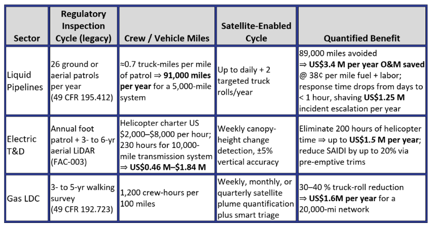
Vehicle Miles × Crew Time: Invisible ESG Multiplier
In addition to the metrics presented in the table above, we consider the broader effects of limiting truck rolls. Cutting 100,000 truck-miles avoids approximately 1,340 tonnes CO₂e (EPA 2025 fleet factor 0.0134 tonne CO₂e per mile for light-duty) and frees 4,800 crew-hours otherwise consumed by windshield time. At a labor loaded-rate of US$78 per hour and a social cost of carbon of US$190 per tonne (2025, 2% social discount rate), those avoided wheels represent US$0.63 M in embedded cost offsets that never hit the O&M ledger but do polish the ESG scorecard at earnings call time.
Reading Cost Savings in Binary From Orbit
The numbers leave little room for nostalgia. Satellite-based geospatial analytics convert the trickle of after-the-fact field observations into a torrent of before-it-hurts intelligence. They are faster than a truck, cheaper than a helicopter, and when the next leak, limb, or plume appears, they are worth more than the clean-up, lawsuit, or penalty they just erased. For operators balancing integrity, reliability, and decarbonisation, the argument is not whether to lift monitoring into the sky, but how quickly to bank the savings once they do.
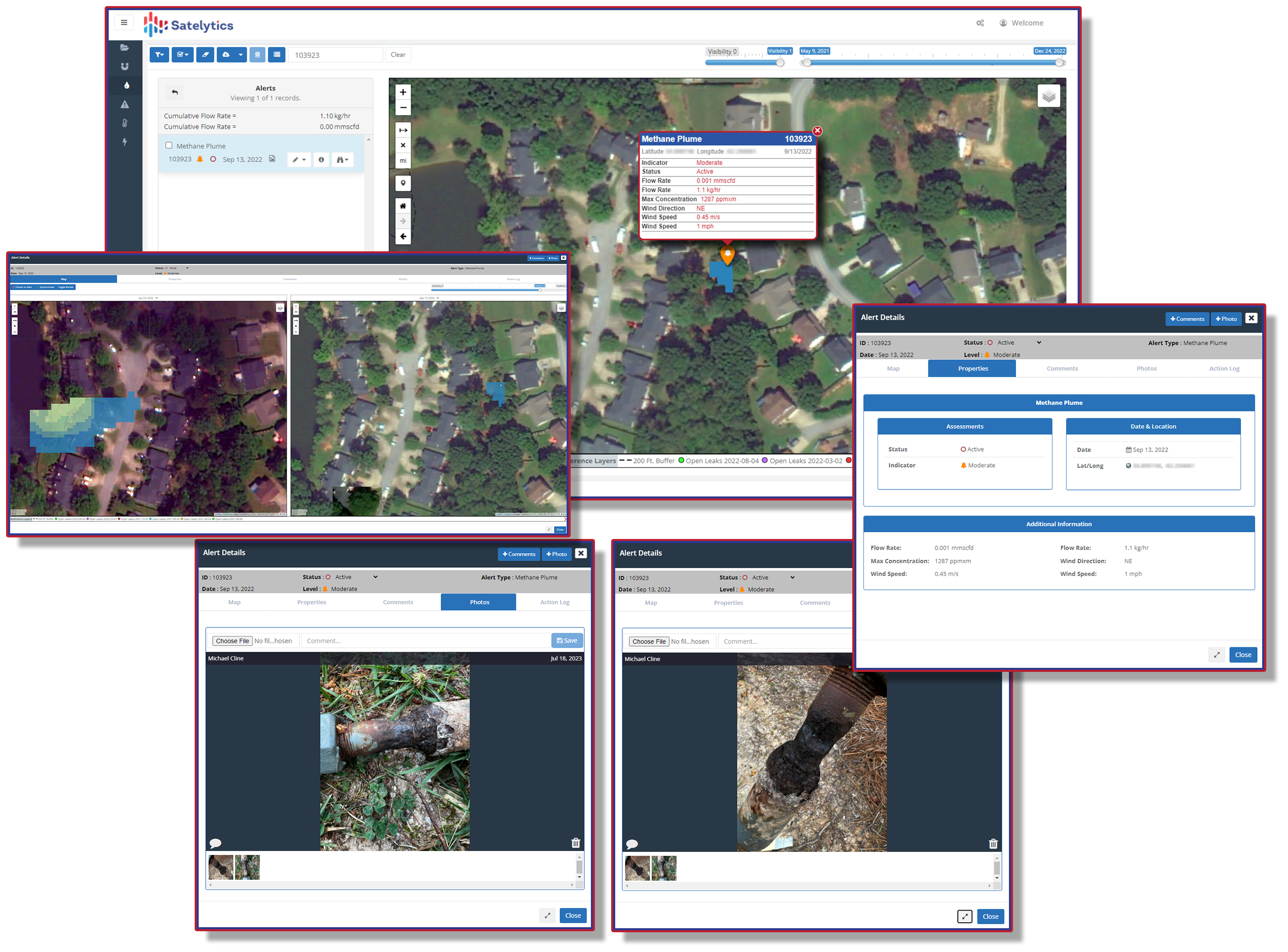
Measure small methane leaks in a gas distribution system.
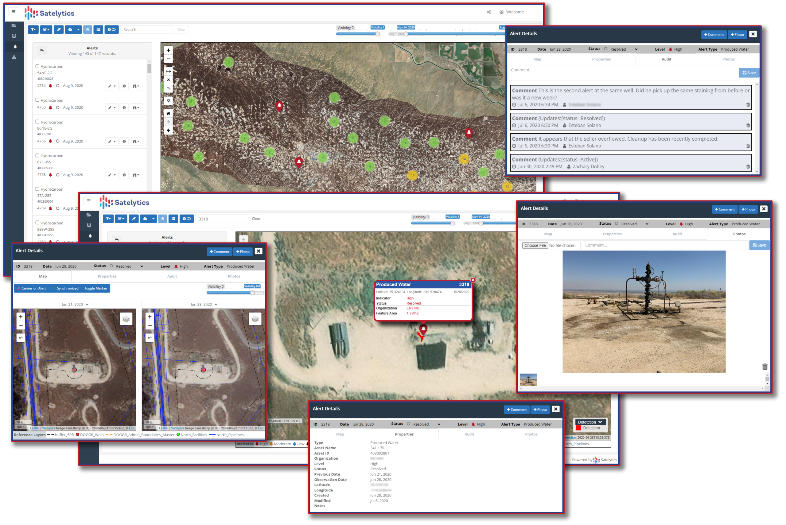
Spot liquid hydrocarbon and produced water leaks before they cost you millions.
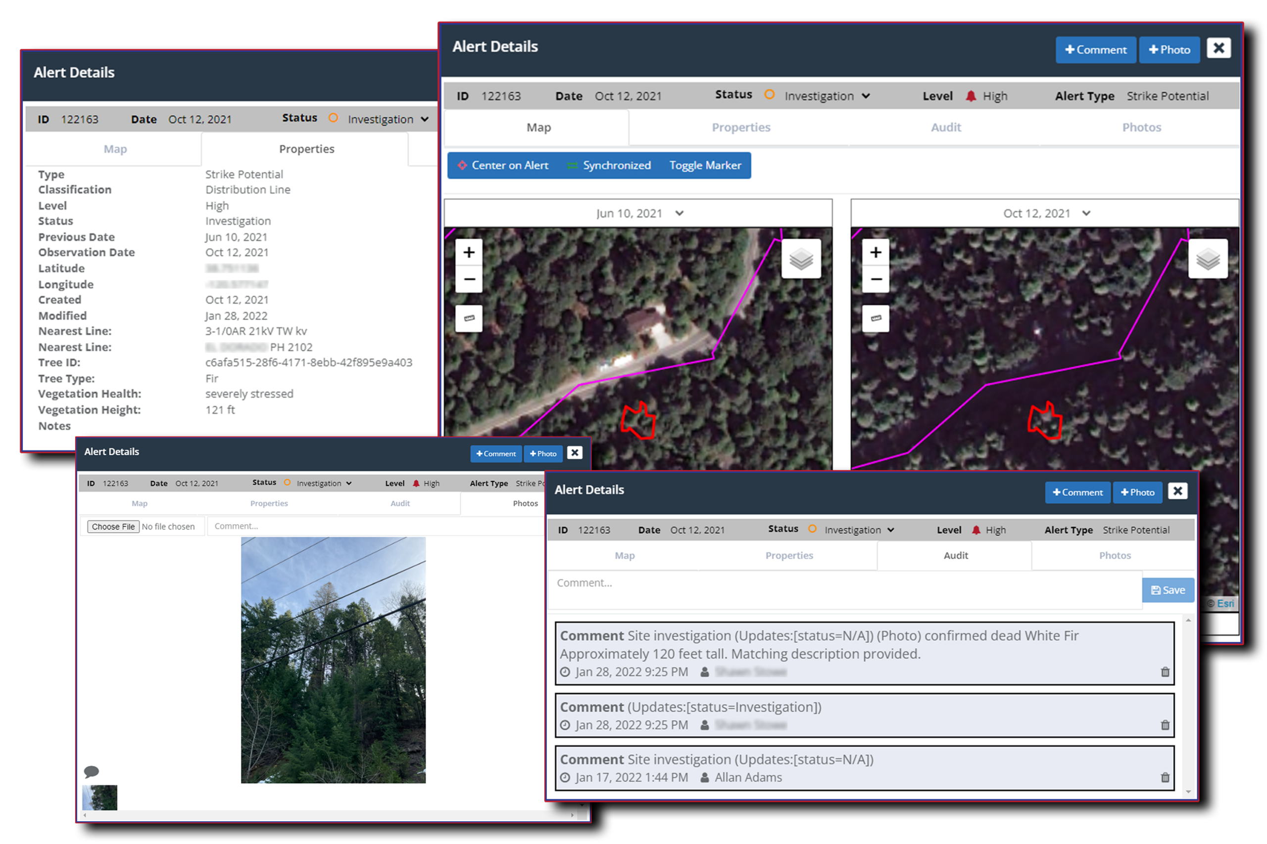
Limit financial risks imposed by nearby vegetation.